Ingolstadt traffic data made live and publicly available
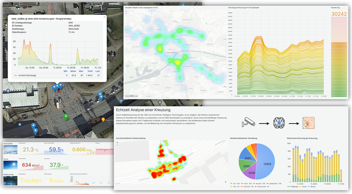
As part of the SAVeNoW research project, count values of motor vehicles from the entire Ingolstadt city area, live traffic data at an intersection and high-resolution weather data have now been made publicly available. The data can be explored via a map application and a dashboard. A detailed documentation highlights the technical and content background. In addition, we will present the web applications at the Tag der Mobilitaet of the THI on 04.10.2023 at the SAVeNoW booth. Feel free to drop by!
The main data source accessed is the detector loops provided as Open Data (#odin) by the Office for Traffic Management and Geoinformation under the direction of Ulrich Schäpe, which are installed at all intersections with traffic lights. Each detector provides a count of vehicles every 15 minutes, so that the traffic volume for the most important intersections in Ingolstadt is available in 15-minute aggregates, accurate to the lane.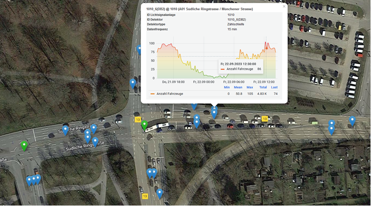
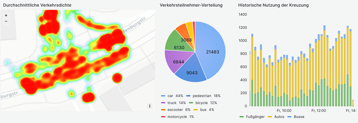
The second data source represents a traffic camera installed at the intersection of Hindenburg Street and Ringler Street. This records the paths (trajectories) of all road users, i.e. also the so-called Vulnerable Road Users, who travel on the bicycle lanes and sidewalks and cannot be counted by the detector loops. Data protection is maintained in that only the trajectories are stored and not the camera image. In addition, due to your installation, the camera is not able to detect faces or license plates.
Finally, the dashboard shows data from a high-resolution weather station installed at a Frauenhofer IVI lab near Ingolstadt Village as part of a sensor data validation effort.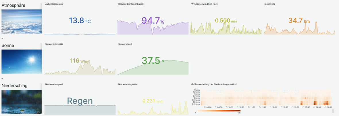
In order to make the data usable for the partners of the research project and the citizens of Ingolstadt, the data is processed and made available on the Internet via a standardized web interface, the OGC SensorThingsAPI. For this purpose, the Chair of Geoinformatics (TUM) has compiled an open source Internet of Things (IoT) application stack in collaboration with e:fs TechHub GmbH. Currently, the data and services are being transferred to the cloud data platform SDK (Superb Data Kraken) for longer-term and stable availability.
Jörg Sichermann
Researcher
My research interests include data analytics, digital twins and cloud computing.